This weekend I attempted a reasonably ambitious trip, back-to-back solo winter Presidential Traverses. I did not make it. But I did walk out alive.
There are a few more photos than those here in the gallery.
Traverse
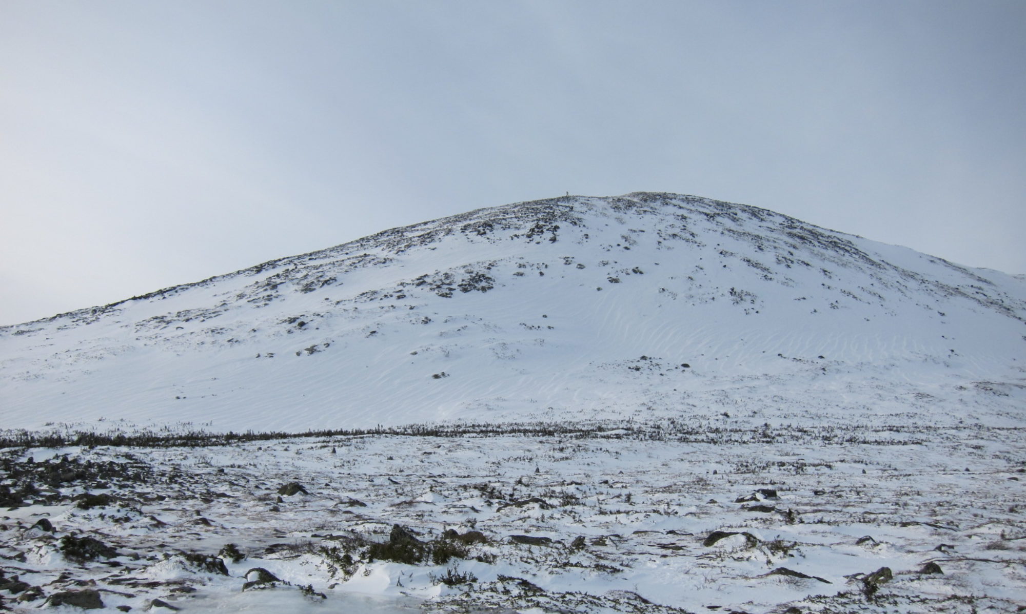
A Presidential Traverse is a hike across the seven summits of the White Mountains named for presidents of the United States: Mounts Madison, Adams, Jefferson, Washington, Monroe, Eisenhower, and Pierce. Depending on the specific route taken there can be a few other summits along the way. In winter it’s typically done north-to-south as a ~12–16 hour day hike, shuttling cars. That direction trends downhill, and most people don’t want to break it up over multiple days by camping above treeline or detouring significantly to get lower. The hiking is one thing, but the real challenge is weather: Famously unpredictable, volatile, and often extreme wind, cold, and snow.


My plan was to go south-to-north day one, camp just below treeline, and come back north-to-south the next day. That’s bold, but I covered almost all the variables I could: Trained several months toward fitness, multiple recent trips to the Whites and elsewhere working technique and task-specific conditioning, calorie counting to trim down, well tuned gear kit, and so on.
You can’t control everything though.
Of the planned ~15.36 miles, 7500ft gain/13000ft change for the first day, I made ~13.5 miles, 7000ft gain/11000ft change, covering Mounts Pierce, Eisenhower, Franklin (not a president), Monroe, Washington, Clay (not a president), Jefferson, and Adams in reasonable time despite some setbacks. Heading toward the final summit on Mt Madison and downturn to camp though I got caught in a snow squall and had to shelter in place on the shoulder of Mt Adams, well above treeline, and abort the next morning.

Setbacks
A bit of prologue drama was that I had to scrap my planned Friday drive north due to the random Nor’easter that popped up. In the morning I was skeptical that the dire forecasts would bear out, but I was glad I hadn’t tried to travel as photos and stories started filtering in from all over of snow, downed trees, flipped trucks, closed roads, and other disasters. So I left Saturday, leaving a bit late in mostly fulfilled hopes of all the roadways being fully cleaned up. I changed plans slightly accordingly to just sleep in the car overnight at the trailhead rather than hiking up to a tent site just below treeline, exchanging a steep but non-technical ~2 miles for not having to break camp in the morning.
Finally underway on Sunday, over the first half of the day I made great time while moving, but had two setbacks.
A blister developed on my left heel very early, inexplicably as I’ve used all my footgear for many years with zero discomfort ever. I managed to keep it well under control but only by stopping several times to break down all my footgear—no trivial process—and tape it up, burning valuable time.
Foreshadowing what was to come, while I was working up one side of Mt Monroe, a heavy cloud bank rolled in the other. With the summit itself having blocked the view of the trail beyond the peak and not being able to make out any markers from there in the poor visibility, I was at a loss for where to go. After retreating a bit to snack and see what would develop, the clouds eventually eased up. While debating my schedule and what this weather meant for conditions on the northern peaks, a group traversing the other direction said the weather hadn’t been any worse, so I pressed on.


Snow
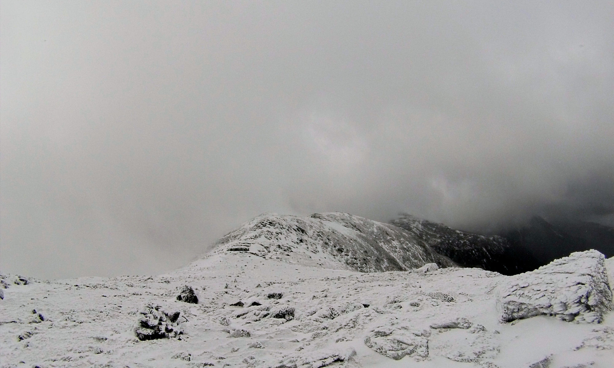
From there I was pushing my ideal timeline but in bounds and and moving very well. Immediately on summiting Mt Jefferson though heavy clouds closed in for good and started to snow lightly. I lost that trail in the limited visibility and had to orienteer down to the next segment. With the gloom the thought settled in now that this was for real, and all the decisions that went into this trip could turn out very consequential. But I was still warm, untired, the wind calm, and visibility good enough to not walk off anything, so I carried on in good spirits. Approaching Mt Adams I similarly lost the trail again but on its comparatively shallow, non-technical slope was able to hit the summit marker and pick it right back up. Navigating in these poor conditions slowed me down significantly though, burning up yet more precious time.


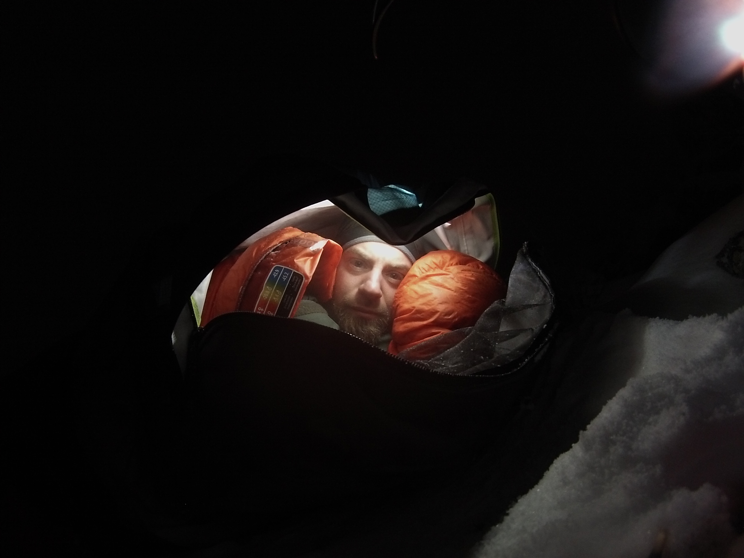
Shortly after that the visibility suddenly dropped enough to make progress over the rocks challenging, let alone navigating. With sunset also coming on, I decided I needed to get safe, now. It took a bit to find workable stable ground to bivouac on, and just after I’d settled in and gotten everything battened down, the wind kicked up and it began to snow heavily. Comfortable temperature-wise but incredibly uncomfortable scrunched up to fit on a ~5 ft rock (I’m 6’1) because it was the only vaguely level ground I could find (it wasn’t at all level), I slept a few hours in fits off and on. Mostly I listened to the snow falling on my bivvy sack, tossing and turning between “I really want to talk to my wife again” and “Caitlin would be so pissed if she saw this…”
Abort
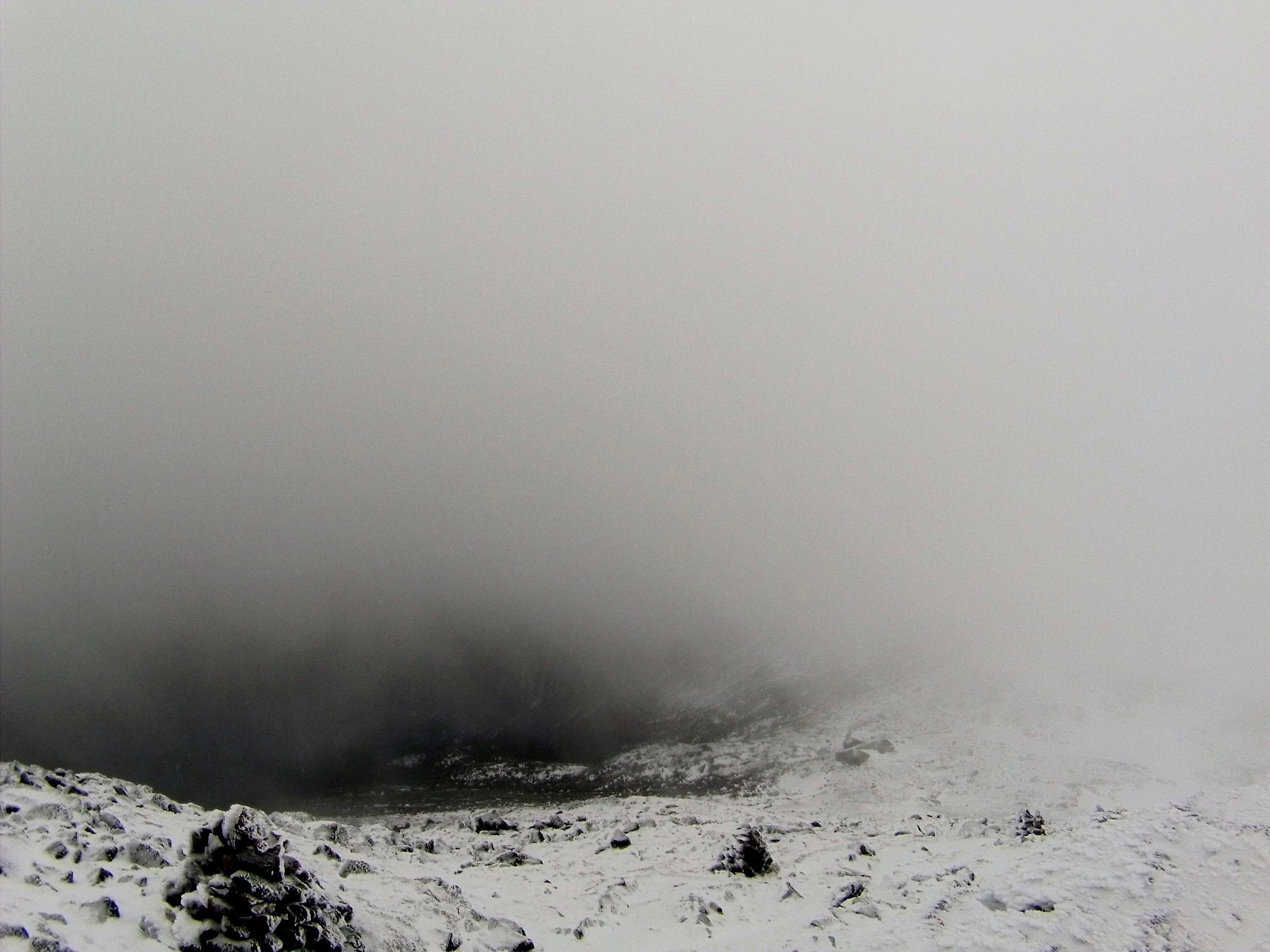
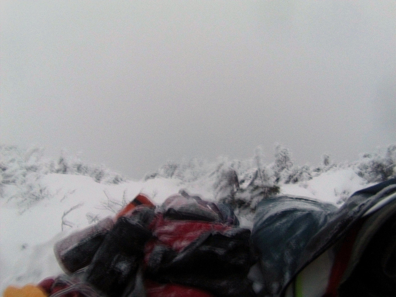
Pre-dawn the snow and wind let up enough to melt snow to refill water bottles and cook breakfast. But after I got moving the temperature started dropping despite day coming on and the wind picked back up. Visibility remained very limited, with the landscape now additionally covered with fresh snow. Giving up immediately on burning time trying to reach Madison but considering trying to hike back roughly as planned, I started orienteering toward the route south.
I had to recognize though, if it’s like this here, what was it going to be like on the rest of the ridgeline? Lots of ways to die alone in the mountains. All the people that have perished on these trails, many much more experienced than I, by definition had at least one thing in common: They all thought they’d make it, right up until they couldn’t. Standing in the growing wind, the notoriously dangerous weather on Edmand’s Col loomed in my mind, with no way to know what awaited there. So I was thinking it was time to start maximizing the probability I’d see my family again when I saw a pair of cairns in the distance downslope headed due north, off the mountains, and made for them.


Once below treeline it was an overcast but nice morning, albeit the trail I’d happened on very steep at times and slick with alternating ice and powder. Several hours later I made it out to the major northern trailhead. Conveniently just after I’d finished changing into somewhat dryer clothes, a nice woman out for a snowshoe loop came back and gave me a ride to a pizza shop just down the road. From there an awesome retired couple with great life stories overhead me talking about my predicament and extremely generously offered to drive me all the way around the range back to the #RacePrius.


Winter
This was my goal outing for the winter, and that pretty much wraps up this season. I could be disappointed. I put a lot of work into preparing for this trip and felt so good physically and mentally, well more than in form for the effort. But I certainly got a real White Mountains experience. I used almost literally every piece of gear I brought, didn’t need anything I didn’t have, and it’s rewarding in its own right to have dealt with circumstances fairly well—blisters, orienteering, bivouacing, fresh snow, and walking out in good enough form to be ready and eager to do it again. It was also a great bonus, after having been so very very isolated for what seemed like a very very long time, to conclude the trip helped out in a big way by such nice, sociable people. All in all, I’m at peace with this outcome and glad I went.
To clearer skies next time!
(again, there are a few more photos than those here in the gallery)
